Updated: Thursday evening, September 22nd
Brief Overview: Lingering swell on Friday with smaller but still fun size leftovers into Saturday AM. New NW/NNW swell pulse for late Saturday into Sunday.
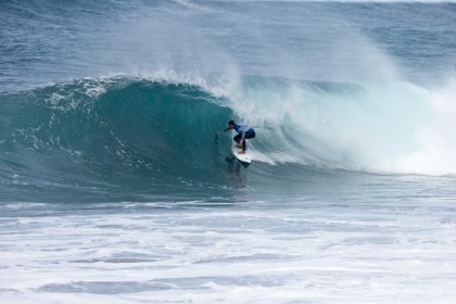
FRIDAY 23rd: Chest/shoulder/head high NNW swell eases.
Swell/Surf: Old NNW swell continues to gradually fade. Biggest early and smallest late.
Wind/Weather: Cloudy with a good chance of rain. Moderate SW winds up to 10-15kts by the PM.
Tides: 5.1’ high 7:15am, 1.9’ low 1:38pm, 4.8’ high 7:50pm
SATURDAY 24th: Waist/chest high NNW swell in AM. Potential for touch more size later PM.
Swell/Surf: Old, leftover NNW swell in the morning before the next round of NW swell fills in over the afternoon/evening.
Wind/Weather: Sunny with some clouds. Early WNW wind. Wind shifts N but remains pretty light through the afternoon.
Tides: 4.9’ high 8:28am, 2’ low 3:00pm
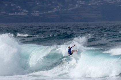
SUNDAY 25th: Shoulder/head/head+ high NNW/NW swell. Expect a few bigger overhead sets around the optimal tides.
Swell/Surf: new NNW/NW swell keeps fun/good size surf in the water.
Wind/Weather: Partly cloudy. S breezes.
Tides: 5.0’ high 8:46am, 1.9’ low 4:19pm
Swell/Surf Outlook
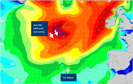
A storm that previously moved through the Labrador Sea and far North Atlantic earlier this week has sent a nice shot of NW/NNW swell to the region. NNW swell from this storm system has peaked but will continue to linger through Friday into Saturday.
The next system of interest is currently NW of the island. This storm will track toward Iceland Friday/Saturday. Winds associated with this storm will set up a reinforcing shot of NW/NNW swell for Saturday afternoon before peaking on Sunday. Swell from this hits head high to a little overhead Sunday. A few bigger sets are likely around the optimal tides. Light/gentle S winds/good conditions expected.
Next Update: This will be the final update.
– Mike
Mike Watson

