ISA World Surfing Games – Official Forecast
Updated: Friday Afternoon, June 5th (Local Nicaragua Time)
BRIEF OVERVIEW
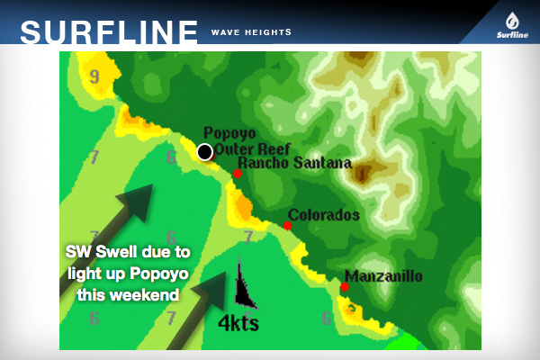
Primary SW Southern Hemi swell will increase further this weekend, providing good size surf for the Finals (overhead+). Even secondary W swell from Hurricane Blanca will mix in. Wind/weather will be variable all weekend, but the first half of each day will generally offer the best conditions.
SATURDAY (6th): Primary SW swell (235-205°) slowly increases further. Secondary West Blanca swell mixes in.
SURF: Sets hang around chest-head high to 1-2 feet overhead through the morning at Main Reef, picking up to a few feet overhead+ over the afternoon. Note – Surf will be a little more peaky/jumbled for the reef due to the swell combo, but still good waves on tap. NOTE – Expect larger sets to show at Outer Reef.
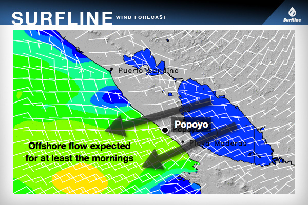
WIND/WEATHER: Light+ early becoming moderate+ offshore East wind through the morning. Wind looks to slack off mid-day into the early afternoon, then turning onshore and becoming moderate over the mid to late afternoon. Partly to mostly cloudy skies. Greatest chance for rain late in the day.
TIDES: 9’ high at 5:06am, 0.4’ low at 11:18am, 9.2’ high at 5:20pm.
SUNDAY (7th): Primary SW swell (235-205°) tops out and holds, along with secondary West Blanca swell.
SURF: Waves will be mainly around head high to 2-3 feet overhead all day at Main Reef, with occasional double overhead sets. Note – Surf will be a little peaky/jumbled for the reef due to the swell combo, but still good waves on tap. NOTE – Larger sets at Outer Reef.
WIND/WEATHER: Light+ early becoming moderate+ offshore East wind through the morning. Wind looks to slack off mid-day into the early afternoon, then turning onshore and becoming moderate over the mid to late afternoon. Partly to mostly cloudy skies. Greatest chance for rain late in the day.
TIDES: 9’ high at 5:52am, 0.5’ low at 12:07pm, 9’ high at 6:08pm.
WEATHER OUTLOOK
Models indicate that we will see a lot of instability throughout the region over the weekend, with a possible area of low pressure slowly developing well offshore. Therefore, scattered showers and T-storms are imminent throughout. Also, there will likely be periods where the wind will swirl around, changing constantly, especially with local storms nearing or passing through the area. Greatest chance for rain late in the day. Overall, mornings will continue to offer the best wind conditions each day.
EXTRA NOTES
- Although the left is traditionally the premiere wave at Main Reef, the left and right will be working pretty well on this SW direction.
- The surf for this reef break is expected to become a little jumbled on the weekend with the combo of SW and W swells, with a shifty take-off zone and some sections down the line. Still plenty of good waves on offer.
- Expect the surf to be strongest/most consistent during the incoming tide push, and on the dropping tide. Surf will be a little drained out with sections during the peak low tides, and slow/fat during the peak high tides. However, one of the good things about Main Reef is that is can handle all tides.
Jonathan Warren
[email protected]
@JWarrenSurfline

